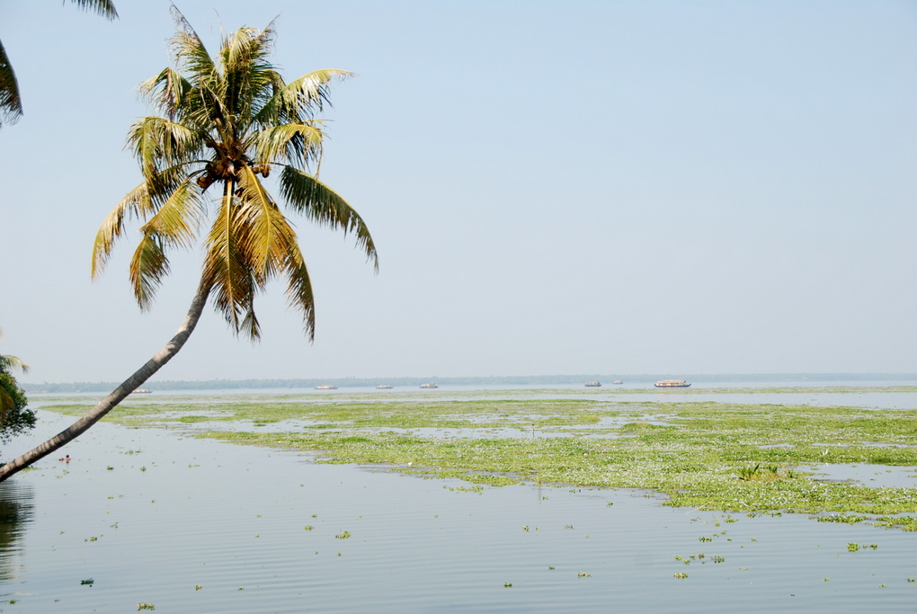
TEA PLANTATIONS OF KOLUKKUMALAI
Kolukkumalai (Tamil: கொழுக்குமலை, Malayalam: കൊളുക്കുമല) is a small village/hamlet in Bodinayakanur Taluk in the Theni District of the Indian state of Tamil Nadu. It is home to the highest tea plantations in the world with the tea grown here possessing a special flavour and freshness because of the high altitude. .

ROUTE
TRIVANDRUM---PUNALOOR---PATHANAPURAM---KONNI---RANNI---KANJIRAPPALLY---ERATTUPETTA---VAGAMON---KATTAPANA---NEDUMKANDAM---RAJAKKAD---MUNNAR---SURYANELLI---KOLUKKUMALAI---SURYANELLI---POOPARA---UDUMBANCHOLA---NEDUMKANDAM---KATTAPANA---KUTTIKANAM---MUNDAKAYAM---ERUMELI---RANNI---PATHANAMTHITTA---ADOOR---KOTTARAKKARA---KILIMANOOR---TRIVANDRUM
ESTIMATED DAYS OF TRAVEL---10 DAYS
TOTAL DISTANCE---622 KMS
PETROL EXPENSE---RS.760/-
FOOD---RS.3000/-
HOTELS AND OTHERS---RS.5000/-
ATTRACTIONS
VAGAMON
Vagamon (Malayalam: വാഗമൺ) is a hill station located in Kottayam-Idukki border of Idukki district of Kerala, India. It has a cool climate with the temperature between 10 and 23 °C during a summer midday. It is situated 1,100 metres above sea level. Vagamon was discovered by the British who found the place ideal for tea plantations and they were followed by Christian missionaries who built their abode of service at Kurisumala in Vagamon. National Geographic Traveler has listed Vagamon on their directory of the '50 most attractive places to visit in India.

Places of Interest
- The nearby Kurisumala Ashram is an abode of calm and spiritual delight. This hill area includes 12 sub mounds wherepilgrims visit. Travelers can enjoy trekking and climbing this high hill. The area is fully surrounded with Tea estates and lakes.
- Indo-Swiss Project Dairy Farms: Indo-Swiss Project dairy farms is situated on the Kurisumala hill. The dairy farm is managed by the Kurisumala monks (restricted entry).
- Mitraniketan: Padma Shri Laurie Baker's & wife Dr. Elizabeth Baker's previous residence (ashasadan) and workstation (mitraniketan) and also home to nurse Alina Cattani, and Dr. Hildegarde Sina,constructed in 1963, it is famous for its Baker style of construction.
- Vagamon Meadows: The rolling green meadows of Vagamon has a lake amidst them. It has for long been a favorite location for shooting movie songs.
- Pine Forests: A valley having huge lofty pine trees lined in rows (pine valleys is one of the Most attractive place in VAGAMON)
- Mooppanpara: It is a v-shaped canyon, one of the admired view points as well acknowledged as a suicide point. The outlook from the summit of the strenuous climb is amazing.
- Murugan Hill: It is situated near to Thangal Para. A Murugan temple is situated which is devoted to Lord Muruga with gorgeous stone age carving.
- Paragliding and Paragliding Festival

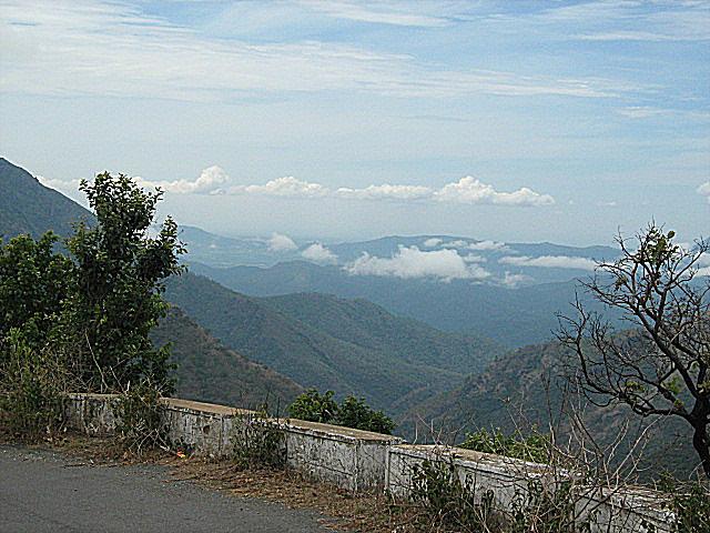
MUNNAR
Munnar is a town and hill station located in the Idukki district of the southwestern Indian state of Kerala. Munnar is situated at around 1,600 metres (5,200 ft) above sea level in the Western Ghats range of mountains.

UDUMBANCHOLA
Udumbanchola is a taluk in Idukki district of Kerala state in India. This is in the high-ranges. Nedumkandam is the major town and capital of Udumbanchola taluk. This taluk borders Tamil Nadu state.This is the biggest taluk in Kerala state and is the location of Mathikettan Shola National Park.

ERUMELI
Erumely is a holy place in Kottayam district of Kerala, India. It is considered holy by both Hindus and Muslims, and is on the way to Sabarimala. Erumely is situated at the boundary of Kottayam District and Pathanamthitta district.

Erumley has its own culture and it's different from all other places with simplicity and unity of Syrian Christian, Hindu, Muslim communities. The agrarian regions surrounding the town have a large presence of Catholic Syrian Christians, who are mainly into rubber cultivation. Hindus and Muslims are found mostly in the town area.

KILIMANOOR PALACE

The Palace complex covers more than six hectares, and comprises the traditional residential structures of Kerala, like the Nalukettu, small and medium sized buildings, two ponds, wells and sacred groves (kaavu). Raja Ravi Varma is said to have built and maintained some of the buildings from the proceeds of his paintings. Families related to the Travancore royal house continue to live here.