KERALA DELIGHT
A JOURNEY FROM SOUTH KERALA TO NORTH KERALA
ROUTE
TRIVANDRUM---IDUKKI---MUNNAR---KOCHI---TRISSUR---PALAKKAD---KOZHIKODE---KASARGOD
TOTAL DISTANCE---845 KM(ONEWAY)
ESTIMATED DAYS OF TRAVEL---2 WEEK
PETROL EXPENCE ---RS.2150/-
FOOD ---RS.4200/-
HOTEL AND OTHERS ---RS.11400/-
ATTRACTIONS
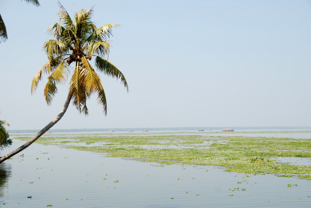
TRIVANDRUM
 Trivandrum, is the capital city of the Indian state of Kerala. It is on the west coast of India near the extreme south of the mainland. Referred to by Mahatma Gandhi as the "evergreen city of India", it is characterised by its undulating terrain of low coastal hills and busy commercial alleys. With a population of 957,730 inhabitants Thiruvananthapuram contributes nearly 80% of the state's software exports and is a major IT hub.

Thiruvananthapuram is a destination for domestic and international tourists. There are many tourist destinations in or near the city including Kovalam beach, Sanghumukham Beach,
Napier museum and
Zoo (Yann Martel wrote his book
Life of Pi after studying a disabled lion, Simba, for months here), Agasthyarkoodam peak,
Neyyar Wildlife Sanctuary and Neyyar Dam, Kuthira Malika
palace, Sree Padmanabha Swamy temple, Ponmudi, Poovar, Varkala Cliffs and beaches and many others.
A VIDEO LINK IS ATTACHED TO THIS FROM YOUTUBE--
The eponymous Sree Padmanabhaswamy Temple circled by the East Fort is at the center of a busy shopping hub. The temple attracts millions of visitors every year. Visitors are required to adhere to special dress code before entering. Recent court battle challenges the custodianship of the Royal family over the temple. The controversy centres on the estimated properties of over $20 billion housed in the vaults of the temple.
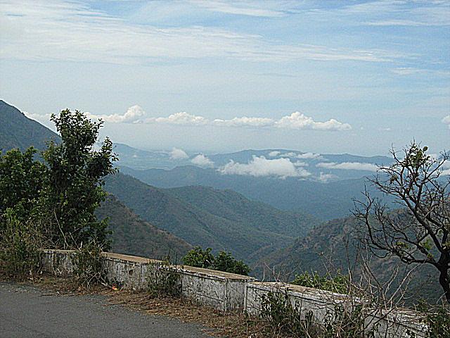
IDUKKI
 Idukki
 is one of the 14
districts of
Kerala state, India.Created on 26
January 1972, at that time the district headquarters was at
Kottayam before it was moved to
Painavu in June 1976. Idukki which lies in the
Western Ghats of Kerala. Idukki is the second largest district in area but has the least population density. Idukki has a vast forest reserve area, more than a half of the district is covered by forests. The urban areas are thickly populated whereas villages are sparsely populated.
Anamudi, the highest peak in India south of the Himalayas, is in the Kuttampuzha Panchayat of Adimali Block, in the Kannan Devan Hills Village of Devikulam taluk. Thirteen other peaks in the district exceed a height of 2,000 m (6,600 ft). The Periyar, Thodupuzhayar and Thalayar are the important rivers of the district. Idukki Dam, Asia's largest Arch Dam is located at Idukki Township of Idukki Taluk. The point where the Periyar flows through the gorge formed between two high massive rocks known as "Kuravan" and "Kurathi" is the site of the Idukki arch dam. The Idukki Hydroelectic project caters for more than 60% of the power requirements of the state of Kerala.
THE ESSENSE OF IDUKKI
Munnar
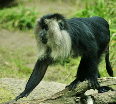
 Munnar was the summer resort of the British Government in the south. The town is situated at the convergence of three mountain streams namely Muthirappuzha, Nallathanni and Kundala. Munnar has some of the largest tea plantations in the world. This hill station, which is more than 5000 feet above sea level, is a well-known tourist attraction noted for its scenic and picturesque landscapes.Most of the native flora and fauna of Munnar have disappeared due to severe habitat fragmentation resultant from the creation of the plantations. However, some species continue to survive and thrive in several protected areas nearby, including the new Kurinjimala Sanctuary to the east, the Chinnar Wildlife Sanctuary, Manjampatti Valley and the Amaravati reserve forest of Indira Gandhi Wildlife Sanctuary to the north east, the Eravikulam National Park and Anamudi Shola National Park to the north, the Pampadum Shola National Park to the south and the proposed Palani Hills National Park to the east.These protected areas are especially known for several threatened and endemicspecies including Nilgiri Thar, the grizzled giant squirrel, the Nilgiri wood-pigeon, elephant, the gaur, the Nilgiri langur, the sambar, and theneelakurinji (that blossoms only once in twelve years).
Vagamon
Vagamon is a hill station situated 1200 meters above sea level, 42 km from Thodupuzha.
This hill station provides option of trekking, paragliding or rock climbing for adventurous seekers. The place has many variety of flora and fauna located in various parts of hilly region. Evergreen tress, tall grasses and shrubs are present in the lower regions of Vagamon. Many rare species of birds, insects, wild buffaloes and elephants can be easily located in the forests. The main attractions here are mist-covered mountains and lakes, Pilgrim centers – Kurishumala, Murugan temple, Burial chamber of Sufi saint and pine forests
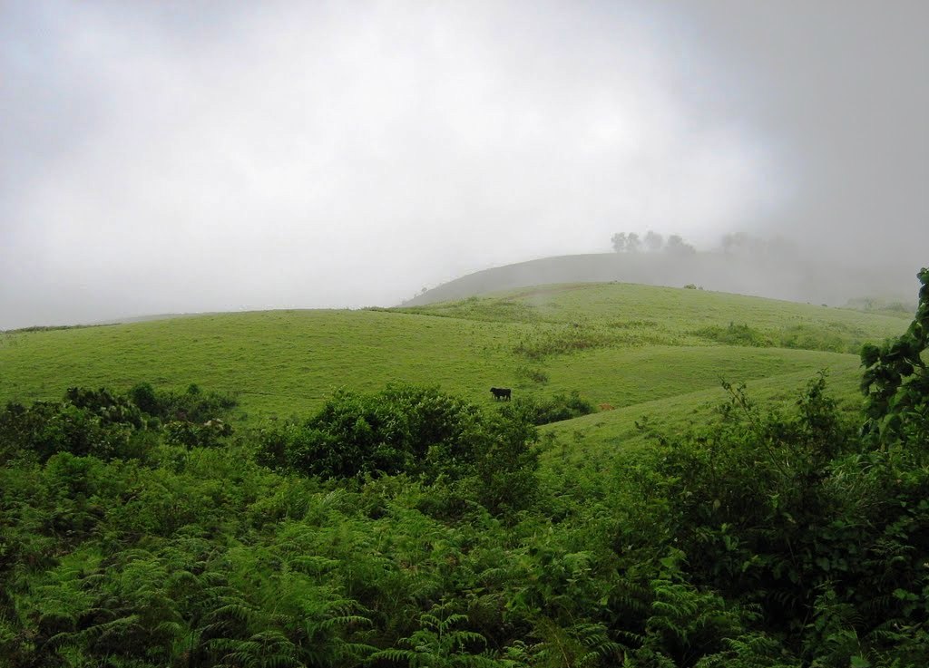
Ramakkalmedu
Ramakalmedu stands tall in the Western Ghats at a height of 3500 feet above sea level. The ecosystem of the area consists largely of grass land Shola forest type which is laced by sporadic bamboo forests.
Constant wind is another factor which makes Ramakkalmedu unique. Wind blows at a speed around 35 km/ hour at Ramakkalmedu throughout the year irrespective of the season and time.Tourism villages like Pushpakandam and Kuruvikanam near Ramakkalmedu is one of the places in Kerala where wind energy farm is installed,though it is private holdings. Currently the capacity is at about 12.5 MW.This electricity is distributed to Kerala State Electricity Board. Ramakkalmedu has potential to produce more electricity, as it is said to be one of Asia's largest windiest area.
Thekkady
The
Periyar Wildlife Sanctuary is spread across 777 km
2 (300 sq mi), of which 360 km
2 (140 sq mi) is thick evergreen forest. The wildlife sanctuary was declared a tiger reserve in 1978. The splendid artificial lake formed by the
Mullaperiyar Dam across the
Periyar River adds to the charm of the park. The greatest attractions of Periyar are the herds of wild elephants, deers, bisons that come down to drink in the lake. The sanctuary can be accessed through a trekking, boating or jeep safari.
Marayur
 Marayur is a remote village on the eastern slopes of the Western Ghats. The relics of new stone-age civilisation has been unearthed here. It has ancient stone cabins, called 'Muniyaras', and is the only place in Kerala having natural growths of sandal wood trees. Marayur has more than 1000 species of flowering plants and is a well known repository of medicinal plants. There are 114 endemic species and the sighting of Aibizia lathamii, a critically endangered tree, was recently reported from the dry forests. Chinnar - the wildlife sanctuary in Marayur - has recorded the largest number of reptilian species, including the mugger crocodile, in Kerala. With 225 recorded species of birds, it is one of the richest areas of south India in avian diversity. The forests in Marayur preserve a population of the endangered grizzled giant squirrel. The rare white bison has been recently reported in Chinnar wildlife sanctuary. Other important mammals found are elephant, tiger, leopard, guar, sambar, spotted deer, Nilgiri thar, common langur, bonnet macaque etc. The phenomenon of butterfly migration occurs in between the monsoons.
KOCHI
PALAKKAD
Palakkad is the gateway to Kerala due to the presence of the Palakkad Gap, in the Western Ghats. Malayalam is the generally spoken language in Palakkad as it is the official language. The town is blessed with many small and medium rivers, which are tributaries of theBharathapuzha River. Of the number of dams in Palakkad district, the largest Malampuzha dam is 12 km from Palakkad town.
Tourist attractions
- Palakkad Fort – Fort dating from 1766, built by Hyder Ali of Mysore. In 1784, after a siege which lasted eleven days, the British Colonel Fullerton stormed the Fort. Later it fell into the hands of the Zamorin’s troops, but was recaptured by the British in 1790. This well-preserved fort is also known as Tipu's (Tipu Sultan, son of Hyder Ali) Fort. Today there is a functioning jail and Hanuman Temple in the fort grounds.
- Jainimedu Jain Temple of Jainimedu – Situated on the western border of Palakkad town and not far from the railway station, this is an historic Jain Temple. The area around the temple is known as Jainimedu. This is one of the few places in Kerala where vestiges of Jainism in Kerala have survived without substantial damage. The granite walls are devoid of decoration. The temple, 32 feet (9.8 m) long and 20 feet (6.1 m) wide, consists of four divisions with images of Jain Thirthankaras and Yakshinis in three of them. Kumaran Asan wrote his monumental poem Veena Poovu (the fallen flower) at a Jain house here during his brief stay with his master Sri. Narayana Guru.
- Kalpathy One of the 21 Agraharams of Palakkad District on the banks of the Kalpathy river, famous for its annual Ratholsavam (Temple car Festival) and annual music festival. One of the oldest settlements of Tamil Brahmins in Kerala, it dates back to the 15th century. These Brahmins speak both Malayalam and Tamil.
- Malampuzha Dam and Gardens -Malampuzha Dam is located eight km from Palakkad town. It was built in 1955 and the garden was renovated recentlly. The main attractions are the suspension bridge, the cable car ride and the fantasy park. There are several gardens including one cute Japanese garden. The Yakshi statue of Kanayi Kunhiraman is also reputed even though the nudity of the structure is not approved by the conservative society of Kerala. The dam is accessible by bus and the last bus returns to town by 8.00 pm. The nearest railway station is Palakkad Junction which is otherwise known as Olavakkod.
KOZHIKODE
 The city has a strong mercantile aspect. The main area of business was once Valiyangadi (Big Bazaar) near the railway station. As time progressed, it shifted to other parts of the city. These days, the commercial heart has moved to Mittai Theruvu (Sweetmeat Street or S. M. Street), a long street crammed with shops that sell everything from saris to cosmetics. It also houses restaurants and sweetmeat shops. Today, the city has multiple shopping malls. Focus Mall (the first shopping mall in Kerala), HiLITE Mall (the second largest mall in Kerala) and RP Mall are a few among them. Currently, new shopping malls are springing up all over the city. This has changed the consumer habits, shifting the centre of commerce from S. M. Street to these places.
KASARKODE
The administrative language of the town and municipality is
Kannada.
The Malayalam spoken here has influences from Beary bashe and also from the languages of Kannada, Urdu, Konkani and Tulu. The Kannada and Tulu spoken here are also influenced by Malayalam.